Table of Contents
The Significance of Global Shipping Routes Map
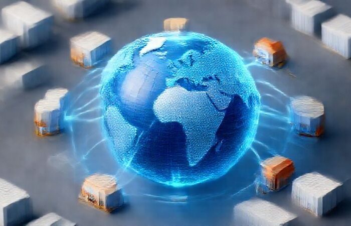
In the intricate web of global trade, shipping routes serve as the vital arteries that connect economies across continents. A global shipping routes map provides a comprehensive visual representation of these maritime highways, offering invaluable insights for businesses, logistics professionals, and policymakers. These maps reveal the complex network of pathways that facilitate the movement of goods, highlighting major trade corridors, strategic chokepoints, and port distributions that underpin the global economy.
The map showcases how maritime shipping, which accounts for approximately 90% of global trade by volume, relies on specific lanes and channels to efficiently transport commodities and manufactured goods. By understanding the geography of shipping routes, stakeholders can optimize supply chain strategies, anticipate potential disruptions, and identify opportunities for trade expansion.
Major Global Shipping Routes and Their Economic Impact
The Asia-Europe Corridor
The Asia-Europe corridor is one of the busiest and most economically significant shipping routes. It primarily utilizes the Suez Canal to link major Asian ports such as Shanghai and Singapore with key European hubs like Rotterdam and Felixstowe. This route supports the massive flow of consumer goods, electronics, and machinery from Asia to Europe, as well as the transport of raw materials in the opposite direction. The efficiency of this corridor directly impacts the economic health of both regions, enabling just – in – time manufacturing processes and timely product deliveries to consumers.
The Trans-Pacific Route
Connecting Asia with North America’s West Coast, the Trans-Pacific route is crucial for trading between Asian nations and the United States and Canada. Ports like Los Angeles and Long Beach serve as primary entry points for Asian goods entering North America. This route is vital for industries reliant on imports of electronics, apparel, and automotive parts. The route’s efficiency influences retail pricing and inventory management for numerous North American businesses.
The Transatlantic Route
The Transatlantic shipping route has been a historical backbone of global trade, connecting North America with Europe. Major ports such as New York on the North American side and Rotterdam on the European side handle a diverse range of cargo, from automobiles and machinery to chemicals and agricultural products. This route reflects the deep economic and cultural ties between the two continents and remains essential for maintaining transatlantic supply chains.
The Middle East-Asia and Middle East-Europe Routes
These routes, centered around the Strait of Hormuz, are the lifeblood of global oil trade. Tankers transporting crude oil from the Middle East to Asia and Europe pass through this narrow strait. The Strait of Hormuz is one of the world’s most strategically important chokepoints, with daily shipments of over 20 million barrels of oil. Any disruption here can have immediate and severe impacts on global energy markets and economic stability.

Strategic Chokepoints and Their Influence on Global Trade
The Strait of Malacca
Located between Indonesia, Malaysia, and Singapore, the Strait of Malacca is a primary maritime gateway connecting the Pacific and Indian Oceans. Over 80,000 vessel transits recorded in 2022 highlight its role as a major conduit for trade between Asia and Europe. It is particularly vital for the transport of oil from the Middle East to Asian economies and for goods moving from Asian manufacturing hubs to European markets. Its narrow width and high traffic density necessitate precise navigation and security measures to prevent accidents and piracy.
The Suez Canal
As a man-made marvel, the Suez Canal provides a crucial shortcut for ships traveling between Europe and Asia, avoiding the lengthy journey around Africa. Supporting approximately 10% of global trade, the canal’s strategic importance was dramatically illustrated by the Ever Given incident in 2021, where a grounded container ship blocked the canal for several days, causing significant ripple effects across global supply chains. The canal is also a key route for oil tankers transporting Middle Eastern crude to European refineries.
The Panama Canal
Connecting the Atlantic and Pacific Oceans, the Panama Canal facilitates efficient trade between the east and west coasts of the Americas and serves as a vital link for Asian trade with the US East Coast. The canal’s expansion in 2016 allowed larger vessels to pass through, enhancing its capacity to support growing global trade demands. Its strategic position reduces shipping times and costs compared to the alternative route around South America.
The English Channel and Strait of Dover
The English Channel is recognized as the busiest shipping lane globally, with over 400 – 500 vessel transits daily. The Strait of Dover, the channel’s narrowest point, requires ships to navigate in defined lanes, much like a two – lane highway. This chokepoint is crucial for connecting the UK with mainland Europe, supporting the flow of goods that sustain the region’s economy. Its strategic location makes it a focal point for trade between Europe and the rest of the world.
Technological Advancements and Tools for Analyzing Shipping Routes
Digital Mapping Platforms
Modern digital mapping platforms such as SeaRates and shipmap.org provide interactive global shipping routes maps. These platforms allow users to visualize shipping lanes, track vessel movements in real time, and analyze traffic density across different routes. By overlaying data such as port facilities, shipping times, and cargo volumes, businesses can make informed decisions about logistics planning and route optimization.
Data Analytics and Predictive Modeling
Advanced data analytics tools enable shippers to predict potential bottlenecks, assess the impact of weather conditions on shipping times, and evaluate the economic viability of different routes. Predictive modeling helps in anticipating disruptions at chokepoints and planning alternative routes to maintain supply chain continuity. These tools are becoming increasingly sophisticated, incorporating real-time data from multiple sources to provide actionable insights.
Satellite Tracking and Monitoring
Satellite technology plays a crucial role in monitoring shipping routes and enhancing security. Automatic Identification Systems (AIS) and satellite tracking enable authorities and businesses to monitor vessel movements, detect piracy threats, and respond to emergencies. Satellite imagery also aids in understanding the environmental impact of shipping activities and supports efforts to mitigate marine pollution and protect marine ecosystems.
Conclusion
Global shipping routes maps are indispensable tools for navigating the complexities of international trade. They reveal the strategic importance of major shipping lanes and chokepoints, highlighting how geography and geopolitics shape global commerce. By leveraging digital mapping technologies and data analytics, businesses can optimize their logistics strategies, reduce costs, and enhance the resilience of their supply chains. As global trade continues to evolve, understanding these maritime networks will remain crucial for economic success and stability.
If you want to enhance your global shipping efficiency and enjoy the full-process transfer logistics service and ensure that your goods are easily delivered to overseas addresses,you can use looperbuy, a one-stop purchasing-logistics solution:https://looperbuy.com/.
Related Questions & Answers
· How do global shipping routes impact the cost of goods for consumers?
Global shipping routes significantly influence consumer goods costs. Efficient routes reduce transportation times and fuel consumption, lowering shipping costs and, consequently, retail prices. Conversely, disruptions at chokepoints like the Strait of Malacca or Suez Canal can lead to delays and increased costs, which may be passed on to consumers through higher prices. The reliability and efficiency of shipping routes directly affect inventory management and production schedules, impacting the availability and pricing of goods in the market.
· What measures are in place to enhance security at major shipping chokepoints?
Security at major chokepoints is enhanced through international cooperation, advanced tracking systems, and naval patrols. For example, the Strait of Malacca benefits from joint security efforts by Singapore, Malaysia, and Indonesia, supported by other nations like the US and China. Initiatives such as the ReCAAP (Regional Cooperation Agreement on Combating Piracy and Armed Robbery against Ships in Asia) Information Sharing Centre facilitate information exchange to combat piracy. Additionally, technologies like AIS and satellite monitoring improve vessel tracking and threat detection, while naval patrols deter and respond to security incidents.
· How are environmental concerns influencing the optimization of global shipping routes?
Environmental concerns are driving the optimization of shipping routes through cleaner technologies and practices. The International Maritime Organization’s regulations to reduce sulfur emissions have prompted the adoption of alternative fuels like LNG and hydrogen. Ship designs incorporating energy – efficient hulls and wind – assisted propulsion are being explored to minimize environmental impact. Additionally, route optimization software helps reduce fuel consumption by identifying the most efficient paths, balancing environmental goals with economic efficiency.
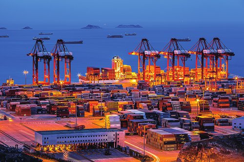
· What role do ports play in the efficiency of global shipping routes?
Ports act as critical nodes in global shipping routes, facilitating the loading, unloading, and transfer of cargo between ships and other transportation modes. Efficient port operations, including modern infrastructure, streamlined customs procedures, and effective logistics coordination, reduce vessel turnaround times and enhance overall route efficiency. Congestion at major ports can create bottlenecks, delaying shipments and increasing costs. Ports also serve as economic hubs, supporting local industries and employment.
· How is climate change affecting Arctic shipping routes and global trade?
Climate change is opening new Arctic shipping routes such as the Northern Sea Route and the Central Arctic Shipping Route. As sea ice retreats, these routes offer shorter, more efficient alternatives to traditional paths through the Suez or Panama Canals. While this presents opportunities for reduced shipping times and costs, especially between Asia and Europe, it also poses environmental risks and geopolitical challenges. The accessibility of these routes depends on ice conditions and requires specialized vessels, making them supplementary rather than immediate replacements for existing trade corridors.
Hot Tags: Maritime Shipping Corridors; Strategic Chokepoints; International Trade Lanes; Shipping Route Analytics; Global Port Distribution; Ocean Trade Networks; Container Shipping Lanes; Marine Trade Routes; Global Shipping Geography